A Winter Walk: The Peaks of Bodmin Moor
The Christmas and New Years holidays mean three things to most people: family, food and bracing winter walks, usually in that order. If you’re visiting Cornwall over the festive period, or are lucky enough to live here year round, then we think we might have just the walk over Bodmin Moor for you to blow away the Boxing Day cobwebs and work off that second helping of roast potatoes. And, if you get back to your car around sunset then you might be lucky enough to witness the amazing murmurations of starlings that happen here.

A Winter Walk Map: The Peaks of Bodmin Moor
- Start & Finish: Rough Tor car park, at the end of a minor road (Rough Tor Road) off the A39 on the north-east edge of Camelford, North Cornwall.
- Distance: approx. 4 miles (depending on route and diversions)
- Time: approx. 3 hours
- Terrain: Challenging – pathless moorland, boggy in lowland and scrambling over rocks required on higher parts. Good navigation skills are essential. Unsuitable when visibility is poor.
- Map: OS Explorer 109 Bodmin Moor
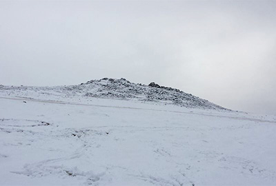
Rough Tor under a blanket of snow
From the car park at the base of Rough Tor, go through the gate and cross the bridge over the small stream onto the moor. Head southeast up the open moorland towards the north-eastern-most outcrop of rocks, marked Showery Tor on maps. There are some vague paths, however the National Trust ask that you avoid the obvious paths as following other people’s footsteps only exacerbates erosion. From Showery Tor you can either continue on to climb Brown Willy, or if time or poor weather are limiting factors then you can turn south and follow the ridge line to the summit of Rough Tor.
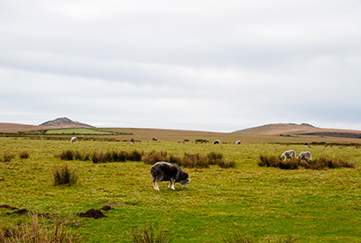
Looking across Bodmin Moor towards the peaks of Brown Willy (left) and Rough Tor (right)
If you’re tackling the longer route then cross over the ridge at Showery Tor and descend the other side, continuing southeast to the site of an old longhouse. The valley here can be extremely boggy, particularly after rain so please pick your route carefully. From the longhouse head south-ish to the end of an old stone bank before turning across the valley and heading uphill to Maiden Tor, the hill just to the north of Brown Willy. From Maiden Tor head uphill, aiming for the Peak of Brown Willy (Bron Wennyly in Cornish, meaning ‘Swallow’s Hill’), the highest point in Cornwall at 1,375 feet above sea level. It is at this halfway point that, after taking in the view over Bodmin Moor (and of both coasts on a clear day) we turn back, heading northwest down hill towards the valley and aiming for the summit of Rough Tor.
If you want instead to take a fairly lengthy diversion to get a look at the Fernacre stone circle, where forty or so of seventy original stones now lie in the peat, aim for the road to the west and take a path north (opposite a farm road) about five hundred meters after the bridge over the river, and climb to the summit of Rough Tor from here.
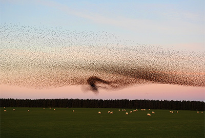
A murmuration of starlings over Bodmin Moor
If you skipped the stone circle, then once you’ve crossed the river in the valley between the two peaks head straight uphill towards the middle outcrop on the ridge ahead (Little Rough Tor), and then turn left and follow the ridge to the summit of Rough Tor. The summit has a small war memorial and, just to the west, a large granite boulder that has been eroded into the perfect chair from which to enjoy the view! From here you can easily see the car park where you began, about a kilometre away to the northwest. The northern slopes of Rough Tor are covered in boulders of varying size that gave the hill its name, so go slowly and carefully pick your way down to the moorland before walking back to your car.