How Do Tides Work?
We get asked about tides a lot. Is the tide in or out? When will it be in/out? Is it the same time each day? The UK has a really large tidal range, so here on the coast of Cornwall the difference between high and low water over the course of a day is obvious to even the most unobservant visitor.

High tide at Port Gaverne
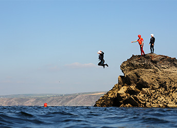
We live our lives by the tides here at Cornish Rock Tors. We observe and experience their rise and fall every day at work; they dictate our working day, from what sessions run when, through to what we can do during each activity session. Take for example a jump feature on one of our coasteering sessions. At high tide the drop into the water could be just one meter – perfect for a first jump in an introductory session. 6 hours later, that same jumping-off point could be 5 or 6 meters above the water, so only really suitable for a group who have coasteered before and built up to that jump over the course of their session. Here at Port Gaverne the difference between high and low tides can be seen on the rocks themselves – above the mean high water mark the rocks are lighter, but when the intertidal zone is exposed after high tide the rocks are darker and covered in more seaweed, barnacles and limpets, with their numbers increasing as the height below mean high water increases.
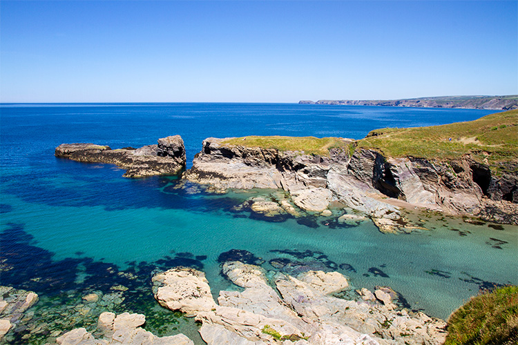
Low tide at Port Gaverne
Tides can be an incredibly complex topic, worthy of their own books and specific modules on university oceanography courses. The basic science behind them though is fairly simple, and we’re going to try our best to distil the facts about tides into a short and easy to understand article. It all starts, with the moon.
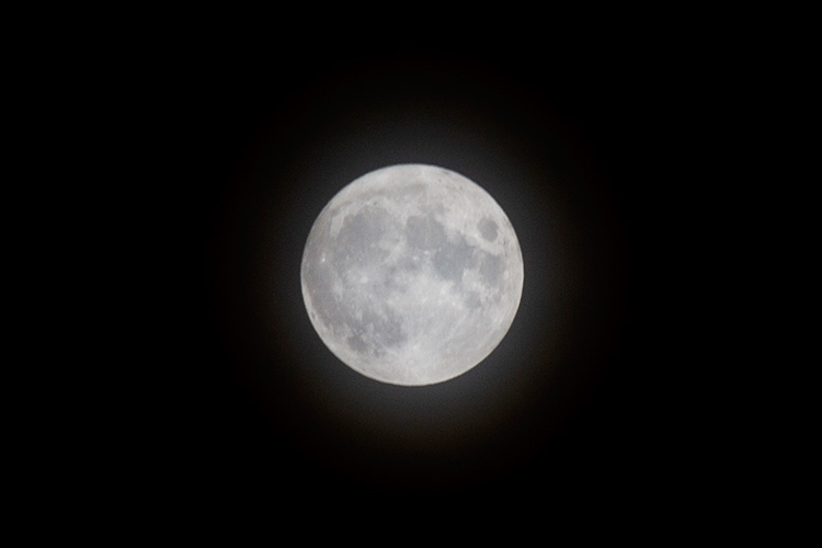
Harvest Moon, September 2021
What Causes The Tides?
The moon (and to a lesser extent the sun) exerts a gravitational pull upon the earth, and upon the oceans. Imagine earth to be a sphere wrapped in water. The gravitational pull of the moon causes the ocean that is directly in line with it to be pulled towards it slightly, causing a bulge in the ocean that we know as high tide. Because the ocean is a fixed volume, where it is being pulled “out” at one point (in line with the moon) it is conversely being squeezed in elsewhere where the gravitational force exerted by the moon is weakest (perpendicular to the moon). This point is low tide. As our planet rotates on its axis once every 24 hours, the bulge of high water stays in line with the moon and the earth moves under it, so high tide does not remain in one point. For most places, in 24 hours any one point passes under the full cycle of high water, round to low, back to another high water and the final low water before returning to the start. This means that there is (approximately) six hours between each high water and low water, and twelve hours between successive high or low waters. This pattern is known as a semi-diurnal tidal cycle (it’s the most common type), with tide times moving on by 50 minutes each day because of the slightly longer length of a lunar day.

How Tides Work
The Tidal Waves
The earth rotates but as humans we center ourselves within our universe, so to us the earth stays still and everything else moves. Therefore the movement of a point under the tides appears to us as high and low water (a peak and a trough) moving around the worlds ocean. These peaks and troughs form waves that move incredibly slowly, with an enormous wavelength (the distance between each peak). These tidal waves flow along coastlines (not in and out) and as peak passes a location (say, for instance, Port Gaverne) it is hightide, then once the peak has passed the tide starts to fall until the trough (low tide) passes. That’s why if you look at a tide timetable (the little yellow books that we sell) there is a chart in the front telling you how many minutes to add or subtract from the times stated for tide times at various different beaches and harbours. The further a beach is from the location at which the tide table is based upon, the greater the difference in time that you will have to wait for the tidal wave to arrive and therefore you will have to add or subtract time.
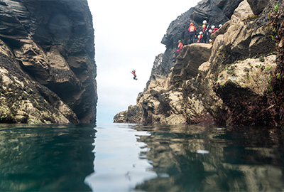
Jumping into The Gut at low tide
For the tide times relevant to us, tidal predictions are based on Newquay and it takes five minutes for each peak and trough of the tide to travel up the coast from Newquay to Port Gaverne, so we would add five minutes on to the times given in the tide book.
What Do Tide Heights Mean?
Next to each prediction of high and low water is a measurement of the height of the tide in metres. This shows how high the high tide will be and how low the low tide will be. Tidal heights change with every cycle of the tide. The heights are given in metres above a point called Chart Datum. At all ports in the British Isles, Chart Datum is the approximate level of the lowest astronomical tide (more on that in a moment). The Newlyn Tidal Observatory, at Newlyn Harbour just outside Penzance, is the original Chart Datum location from which not only all tidal measurements were based, but the point of mean sea level from which every landscape measurement across the country, on every map, was calculated.

Spring Tides
Spring Tides and Neap Tides

Neap Tides
Whilst our tides are powered by the gravitational pull of the moon, the gravitational pull of the sun also plays a role. When the sun and moon are in line, on full and new moons, their combined gravitational pull creates larger tides – higher highs and lower lows. These are spring tides. When the sun and moon are at 90 degrees to each other on quarter or three-quarter moons, and the overall gravitational pull is reduced (they basically work against each other), the tidal range is decreased. These are neap tides, and they are characterised by there being less of a difference between high and low water (which could mean higher lows or lower highs). The lowest astronomical tide (mentioned earlier) that is used as Chart Datum, will be the lowest spring low tide of the year.
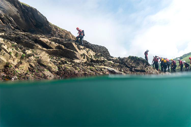
The Intertidal Zone
What Else Affects The Tides?
There are lots of other factors that affect the tides that we experience. Tidal waves moving up a coast can be slowed down or channeled by features on the sea bed or the shape of the coast. Tidal waves flow around islands, and in some cases tidal waves can meet each other – Southampton is an unusual tidal location and successful port because it often has more high tides in a day, one from a tidal wave that has flowed around the UK and entered the Solent from the east, and the other that has come up the English Channel from the Atlantic and entered the Solent from the west. Having more high tides means that more ships can come and go each day compared to all the other ports that have two high tides in any 24 hour period.
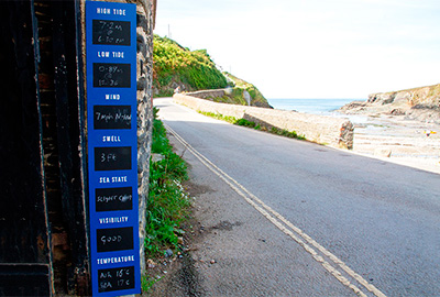
Our new info board
The weather can also affect the tide. Onshore winds push the surface water of the sea towards the coast and make high tides higher. High air pressure also acts to push down on the ocean (suppressing the height of the tide) whilst low air pressure does the opposite and allows the tide to rise higher – if the air pressure drops by one millibar, the local sea level can rise by 1cm.
Beyond these simple geographical or meteorological factors, we start to get into the sort of complicated territory reserved for oceanography textbooks – perigean moons, amphidromic systems, tidal streams and the influence of bathymetry.
Further Reading
If you’ve found this article interesting and you’re curious to learn more about the tides and other systems that affect our coasts and inshore waters, then we’d highly recommend reading either The Book of Tides or The World of Tides by William Thomson. William also runs Tide School, an online educational platform and resource (you have to sign up and pay a small monthly fee to join) based around nine modules, each one exploring a different element that affects your adventures (tides, tidal streams, the moon, winds, waves, rips, stars, clouds, currents).