A Guide To Cloud Spotting At The Coast
Here at Cornish Rock Tors our days are often directed by the weather conditions.
Through the main part of our season, from Easter through to the end of October, we check multiple weather and sea-state forecast sites at various points through the day to help us plan our activities. What’s more, here on the coast the weather is very visible; standing on the Main, the grassy headland above Port Gaverne, one has a view out across a huge and uninterrupted expanse of sea and sky. There are no buildings, or trees, or mountains to obscure the big skies. Back before accurate weather forecasting, people whose lives and livelihoods depended on the weather, such as sailors, fishermen and farmers, had to read the clouds and make a best guess at the weather coming their way. That link to the skies has been broken for most people in modern societies, and even for those of us for whom the weather plays an important role in our lives, that link is now primarily through weather forecasting sites and apps. We thought the topic of clouds worth a revisit, though, so that next time you look up you can appreciate what you’re looking at and maybe even work out whether you need to put a rain coat on. If nothing else it might, like us, make you appreciate the accumulated knowledge of our predecessors, and the amazing technology that now allows us to predict the weather.
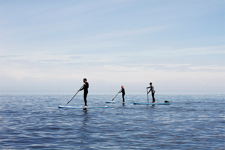
Altostratus and cirrus clouds on a calm summer’s day
What Are Clouds (And How Do They Form)?
Clouds are formed from tiny water droplets. All air contains water vapour, but when there’s too much water vapour for the air to hold, or the temperature falls (cold air can’t hold as much water vapour as warm air) the water vapour condenses from a gas to a liquid and forms miniscule water droplets. This happens when warm air rises, and as it rises it cools. The droplets cling to dust particles, and are visible but so small that they stay suspended in the air (rather than falling as rain). These masses of water droplets are clouds. At very high altitudes where it is incredibly cold clouds are formed from tiny ice crystals instead of water droplets. Clouds are white because they scatter sunlight evenly; rain clouds appear grey because the water droplets are larger and the sunlight doesn’t penetrate through so well, so the part that we see (the underside) appears grey. From above, all clouds are white!
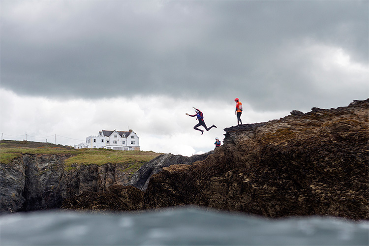
Coasteering underdark nimbostratus clouds
The Different Types Of Clouds
An amateur meteorologist from London called Luke Howard was the first person to classify clouds in 1803, and his system is the basis of the one that we use today. He separated clouds into three types (stratus, cumulus and cirrus), which The World Meteorological Organization then divided into ten groups. Clouds are dynamic though, and don’t always fit neatly into categories but instead exhibit a huge number of combinations and variations. Cloud types are then divided into three sets, depending upon the altitude and part of the atmosphere where they are found (low up to 6,500ft above mean sea level, mid between 6,500 and 20,000 feet, and high clouds above 20,000 feet).
- Cumulus (low cloud) – Classic, fluffy, cotton-wool clouds. One of the most common types. Usually seen on sunny days and an indicator of fair weather.
- Cumulonimbus (low cloud) – Thunderclouds, aka “The King of Clouds”, they have a flat base (with a dark “wall below and a flat top, with a tower of billowing cloud between. Cumulonimbus clouds bring heavy and torrential rain, hail, and thunder and lightning storms.
- Stratus (low cloud) – Low and featureless white or grey clouds, stratus is the cloud type present on overcast days. May mean drizzle or light rain.
- Stratocumulus (low cloud) – Groups of large, clumped stratus clouds with breaks inbetween. The most common clouds on Earth, and present in all types of weather. They are formed near weather fronts so are a sign that the weather is about to change.
- Nimbostratus (mid cloud) – Thick, dark, featureless clouds that form along warm or occluded fronts and deliver continuous moderate precipitation.
- Altostratus (mid cloud) – Thin “sheets” of featureless cloud covering large areas. Often possible to see the sun through the cloud. They form ahead of warm or occluded fronts and usually morph into nimbostratus, so are a sign that the weather is about to worsen.
- Altocumulus (mid cloud) – Layers or patches of white or grey “cloudlets”, altocumulus come in a variety of types and shapes. They are a sign of settled weather.
- Cirrus (high cloud) – All high altitude clouds are a type of cirrus clouds – high, whispy and very white. They are often nicknamed “mare’s tails”. They form from ice crystals in front of warm fronts, and although they may produce precipitation it never reaches the ground but instead forms clouds at lower altitudes. They indicate that a warm front is on its way and that there is likely to be rain within the next 24 hours. At sunset, the underside of cirrus clouds are lit up and coloured by the setting sun.
- Cirrocumulus (high cloud) – Composed of lots of small white cloudlets, cirrocumulus are quite rare and can look like honeycomb or fish scales – hence the term “a mackerel sky”. They are fair weather clouds but can indicate oncoming stormy conditions.
- Cirrostratus (high cloud) – a thin, layered veil of cloud that is so high and so transparent that it’s often not seen, or is only obvious from a halo or arc effect that sometimes forms around the sun. They form in advance of frontal weather systems, so can be used to predict the weather over the next 24 hours (often some form of precipitation).
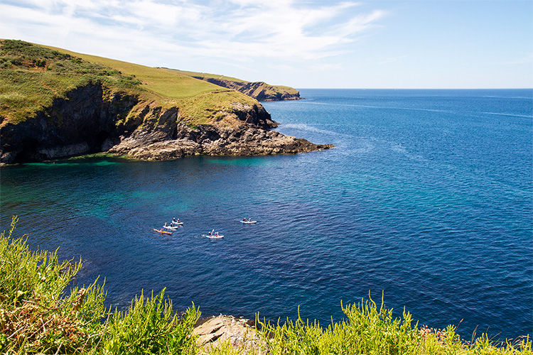
Cirrus clouds along the coast of Port Isaac Bay
Clouds At The Coast
Clouds can behave differently over the sea than over the land, due to the differing temperatures and the rates at which liquids (the ocean) and solids (the land) absorb heat, and because of the changes in topography over land. Sometimes there will be a band of cloud just inland of the coast caused by a phenomenon called sea breeze convergence or coastal frictional convergence. In the case of sea breeze convergence an onshore wind flowing from the sea to the land meets an opposing wind and warm air is forced upwards, forming clouds. This usually occurs through the warmer months of the year. Coastal frictional convergence is caused by the fact that the surface of the ocean is relatively smooth and so wind can flow across realtively quickly, but then over land it is slowed down when it encounters topographical features (cliffs, hills, mountains etc). Air flowing from the sea onto the land is slowed down and piles up, until some is forced to rise, as it does so forming clouds just inland from the coast. Just up the coast from us the land rises from sea level very quickly, up towards Bodmin Moor, which results in increased cloud cover and rainfall just a few miles up the road around Delabole (because of its increased elevation) than here on the coast at Port Gaverne.
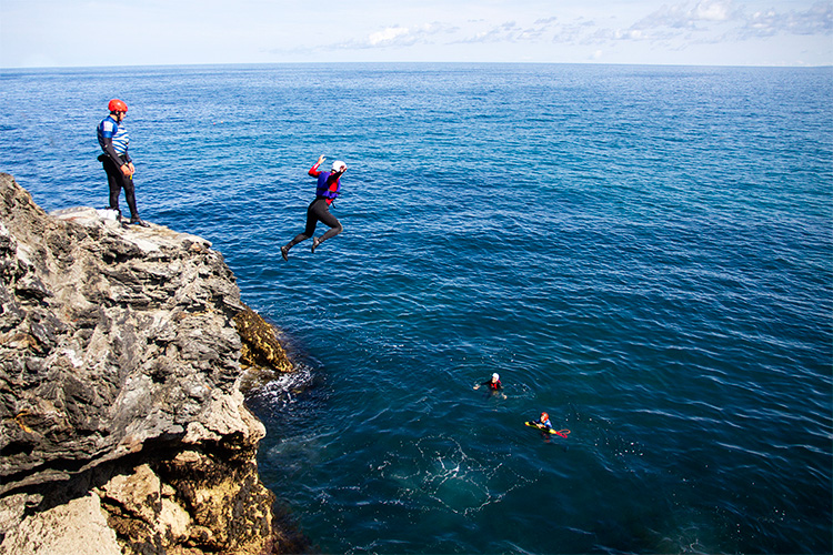
Altocumulus clouds on the horizon – a sign of settled weather
Armed with this knowledge, it’s possible to make some very basic predictions about the weather by looking at the clouds (and their direction and speed of movement) – namely, whether or not it is likely to rain soon. With such clear and interrupted views out to sea and up the coast from Port Gaverne, there’s no better place to spend some time cloud spotting. Cloud watching is one of The National Trusts “50 things to do before you’re 11¾”
Learn more about clouds on The Met Office’s website, or by downloading this handy guide by BBC Weather.